Day 4 Bike Camping the Olympic Peninsula

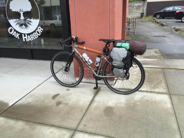
  • Day 4 of the Anacortes to Port Angeles bike touring trip
  • Distance biked: 41.6 kilometres
  • Location: Olympic Peninsula, WA
  • Route: Sequim Bay State Park to Victoria, BC
  • Total trip distance biked: 180 kilometres

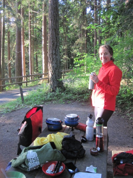
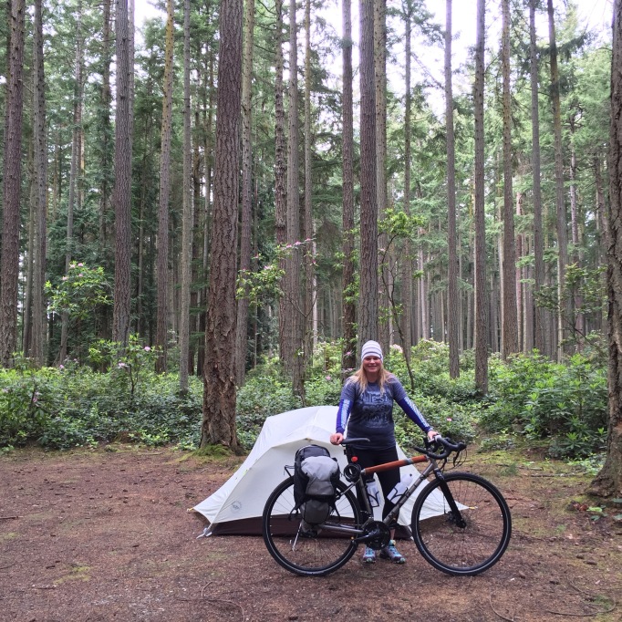
Sibylla & I set the alarm for 6:30 am so we could leave Sequim Bay State Park in plenty of time to make the 2 pm Port Angeles ferry. I got up a little early and took some photos of the campsite. We ate a lot of oats, packed up, and left by 8:10 am. Biked into Sequim proper on the Olympic Discovery Trail, which went right in front of our campsite! So cool.

IMG_2177

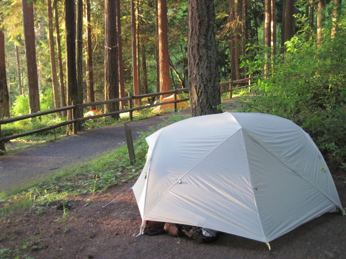
Morning sun in Sequim Bay State Park, WA 

IMG_2184

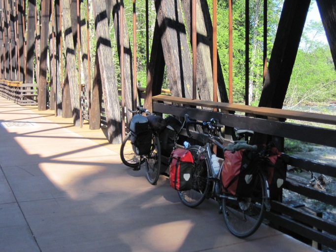
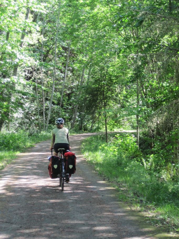
We came off the trail for a grocery store. I got coffee & a sandwich; we both dumped & refilled our water b/c the campground water was really gross. And on our way! It was so cool to have the two-bikes-wide, paved trail to go on for the entire day. Awesome. Since it’s an old railway grade partially, we went over some neat bridges & trestles, and also had quite a few very steep hills down only to climb again right away, where trestles previously were. It was fun going through the neighbourhoods in Sequim, seeing stuff we would never otherwise see. They brought irrigation to the area, and you can see it running right through town. Then the trail wound through country backroads and farmland. A park, a horticulture centre. On it went, all paved, all day.

IMG_2186

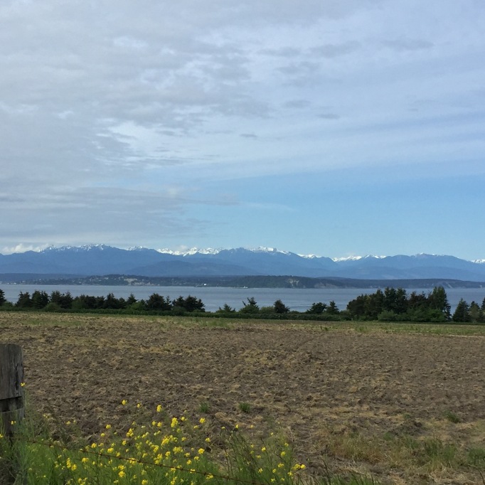
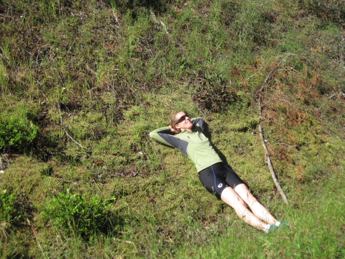
Once the trail came out right beside the ocean for the last section of our trip to Port Angeles, we saw an awesome beach. Long, and great view wide over the ocean. Soft sand near the trail to the beach. We stopped and hung out there for 45 minutes. Had lunch, listened to the ocean, had a nap. It was great.

IMG_2191

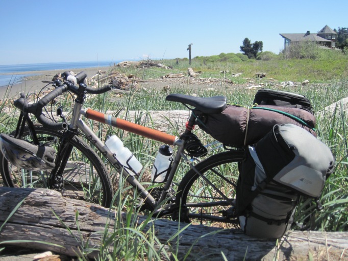
At the beach near Port Angeles

Then on our way again. I stopped to pee at the side of the trail and brushed my bare butt up against stinging nettles by mistake. Ouch. Then we saw some day-bikers whom we’d been leap frogging for part of the day. They had turned around and were coming back towards us. They said a guy who’s touring had told them the trail was closed, washed out, and that he tried to go around, but it was too difficult. We really didn’t want to turn around and go all the way back to the highway, and we didn’t have time, so we kept going, figuring we’d check it out when we got to it. It was closed, but you could get around the fence. The ground had caved in, but it was easy enough to lift the bikes over it and get around. We were happy we’d decided to try. Ten minutes later, there we were at the ferry terminal. Got our tickets, and had almost an hour to spare. We hung out in the shade eating apples. We were going to play Scrabble (Sibs brought the board & pieces on the trip!) but were tired and didn’t get around to it.
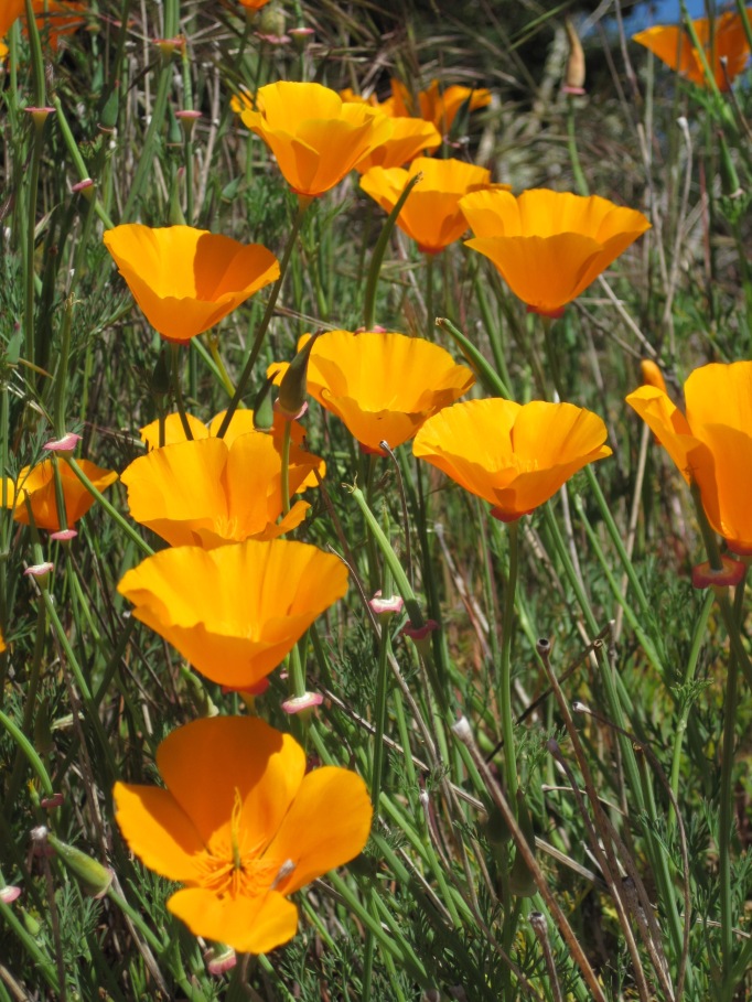
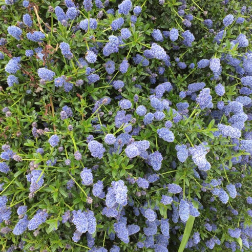
IMG_2188

California poppies

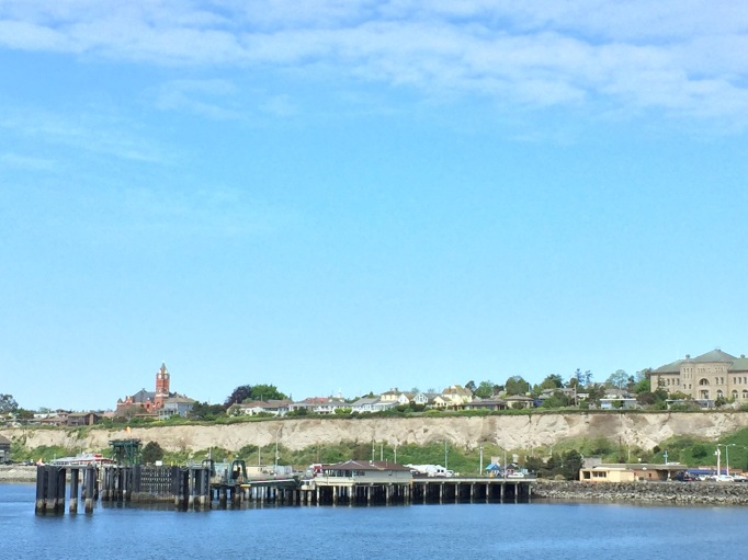
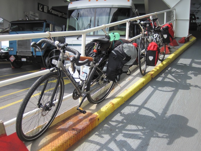
The Black Ball ferry was chaotic. Much different than the calm, spacious Washington State ferries. But we found a great spot outside on lockers on the port side. It wasn’t very cold or windy; different set up than BC Ferries, and we were able to sit out there for the whole beautiful trip. All day we had blue skies, sunshine, and lots of views of ocean and of snow on the mountains. A gorgeous day. We pulled into Victoria Harbour downtown, and going through customs was quick. From there we had a fast and frantic ride through downtown city traffic, along Wharf Street and over the Blue Bridge. Changing lanes, riding in the middle of it all, bringing me back to bike courier days. I love the rush. From there, just a climb and one final downhill, and there we were at Mum’s. Wheeled our bikes into the backyard garden, and she came out. We stayed for a little while and visited, drinking apple juice in the garden. Then Sibylla & I took our bags off our bikes, loaded them on my rack, and drove up through Friday rush hour traffic to Sidney, where her car was parked. Did the last gear exchange, hugs and high fives, and we were off. A really great trip. Can’t wait to do another one soon. I’m hooked.


Bike Camping the Olympic Peninsula: Day 3

  • Day 3 of the Anacortes to Port Angeles, WA bike touring trip
  • Distance biked: 56.7 kilometres
  • Location: Whidbey Island and Olympic Peninsula, WA
  • Route: Coupeville to Fort Casey State Park; ferry to Port Townsend; Port Townsend to Sequim Bay State Park
IMG_2170

Sibylla on the Larry Scott Trail, Washington 

This morning we woke up in Rhododendron County Park, outside of Coupeville. Beauty day. Cold to start, but it warmed up. Porridge & tea for brekky and packed up. Biked towards Coupeville, got a coffee to go from Prairie Perks, a little drive thru place. Then a little ways up to Red Apple Market for some road snacks/groceries. We went in one at a time, the other person watching the bikes. Watched middle school kids stream from a gym to their school, and talked to Chris on the phone. Then we biked to the ferry through Fort Casey State Park; lots of old barracks houses.

IMG_0071

Ocean view on the way to the Coupeville/Port Townsend ferry.

The ferry pulled away, and we could see the bluffs on Whidbey Island. It felt like a short trip. Biked in to Port Townsend, and stayed until 2 pm. We found a bike shop first & got awesome maps for there to Port Angeles, where we’re going tomorrow. We parked our bikes & wandered around.

IMG_0074

Port Townsend, from the water.

Went into an art gallery, and we both really enjoyed that. The work in the back room was varied and interesting. We ate lunch at a great Mexican restaurant, on the water, realizing after we sat down that it was Cinco de Mayo that day. I had a chile relleno plate and it was just perfect — Mexican rice & refried beans & shredded lettuce topped with guacamole. Then we left, and biked up and around one street of historic district houses. I need a whole day just to wander around and look at them. We saw a fire bell tower, that would ring codes telling the volunteer firefighters where the fire was and how severe.

IMG_0084

Galatea Fountain, Port Townsend, WA

It got started getting hot; middle of the day. I took off my polypro and rode in tights and a t-shirt. We started on the Larry Scott Trail for 13 kilometres or so, taking us out of town. It really wore us out or made us feel slow because it was gravel & dirt, not paved. [Sibylla’s in the tent using her bird app to try to figure out what type of owl we’re hearing. I’m at the campground picnic table with my headlamp on]. Pretty, but not much to see on that trail. All trees and bushes, and then past some people’s ranches.

Then we got onto highway. It was crazy — very little shoulder. We climbed & climbed a hill forever. Seriously, it was an uphill climb for at least half an hour, probably 40 minutes. Semis & trucks burning past us. Then a little ways later, we had a 3.2 kilometre downhill. The bike shop guy had warned us about the downhill & the traffic. He said we should take over the lane instead of try to use the shoulder. So we tried to just give’er and take the lane. We went super fast, but cars wanted to go faster, so we mostly went to the shoulder, which wasn’t big at all. We went fast as we could to get out of that section. It was actually fun for me. Then onto chill highway, and road along oceanside bluffy private property side roads that felt like cottage country in the Shuswap. We’d been going over 2 hours so we stopped for food and rest. We weren’t hungry or all that tired, but I wanted to avoid burnout later in the day. Sibs lay on a bank in the sun.

IMG_2172

Deserved roadside break.

Then more rolling hills and highway, getting kind of endless, and on to theOlympic Discovery Trail, and through Klallam territory. Stopped at a gas station & I got wine and deli food for dinner for later. Then 3.5 or 4 kilometres more on the Discovery Trail, making it 57 kilometres altogether, and we turned in at Sequim Bay State Park. We got one of three bike/hike-in sites, that are only $12 and have bike racks. Set up the tent, comfy clothes, took our stuff down to a dock and had dinner. End of another good day.

IMG_2179


Bike Camping the Olympic Peninsula: Day 2

  • Day 2 of the Anacortes to Port Angeles, WA bike trip
  • Distance biked: 44 kilometres
  • Location: Whidbey Island, WA
  • Route: Oak Harbor to Greenbank, and Rhododendron Park campground to Coupeville & return

May 4th (Straight from the journal): This morning we went & found a coffee shop from our motel. It was raining and we were slow-moving. Came back & packed our stuff up, went & filled our water bottles at a stand we saw earlier, and we were out.

IMG_0054

Beautiful ride again, lots of hills again. The ocean and mudflats were on our left, and properties on our right. My favourite was a beautiful wooden house with lawn and trees; that sounds like everywhere but it really was gorgeous. Up and down, up and down. Fun downhills, douglas fir trees, ocean on the left, getting warmer, getting humid, took our raincoats off. We planned to bike a big loop to check out Ebey’s Landing National Historical Reserve, but when we climbed a big hill following a sign, we could see the whole route and it was all prairie. We decided not to do that sidetrack.

IMG_0079

Can anyone tell me what these are? They were everywhere.

We were aiming for Meerkerk Gardens, to see the rhododendrons. I really wanted to go! But we both started fading around 1:30, and hadn’t had lunch, and we decided to look for a beach access. We were going all along a bluff, and everything was private property. Asked someone in a little neighbourhood, & they pointed to a road but said it was really steep. It was really steep! But turned out to be the only beach access, and I’m glad we stopped there. We got to the beach, ate lunch. An old guy in a truck was there and there was a big block of wood he’d come down to take off the beach. You could tell he wanted help with it. We talked a bunch, and he recommended Rhododendron County Park over Fort Casey State Park for a place to camp. We were exploring south of Coupeville but returning later that day to camp near the ferry, so we could get over to Port Townsend the next day.

We ended up helping him  move the wood on his industrial cart, from way down the beach, lifting it over logs and branches and waiting while he hammered the huge nails to the side, and then helping him lift it into the truck. He had left after we first saw him, and we both had a brief nap on the beach, and then he came back, with a bike rack attached! We thought he was just going to help us get up that crazy hill, but then he took us all the way to the campground.

IMG_0057

IMG_0073

You can just see all the rhododendrons in the background here. 

We set up our tent at Rhododendron County Park, about a 15-minute bike ride from Coupeville. I put my sleeping bag and Thermarest in there, and we took everything else with us. Came in, checked out the town, had a pub dinner (pint of draft craft and burger & fries), and then we were looping through the rest of town when we came across the library. I can never resist a library. So we stopped there and did some writing.

Memorable Moments:

  • All the pink rhododendron bushes among the salal and doug fir at the campground. Just beautiful.
  • Picking salmonberries with Sibylla at the roadside, midway up a hill. First of the year!
  • Meeting Curtis, who has many interests. He had found an old map based on local ethnographies, and used it to find one end of a traditional canoe portage, among other sites.
IMG_0069

Coupeville heritage house. New England sea captains started this town; there are many great buildings like this. 

Bike Camping Olympic Peninsula: Day 1

My friend Sibylla and I packed everything onto our bikes and toured a 4-day loop from Sidney, north of Victoria on Vancouver Island, across to Anacortes, Washington, down Whidbey Island to Port Townsend, across to Port Angeles on the Olympic Discovery Trail, and back to Victoria. Total distance: 180 kilometres. Average distance per day: 45 kilometres. Bike: Marin Four Corners touring bike. This is our trip, taken straight from my journal:

IMG_2179

Our campsite right on the Olympic Discovery Trail.

Tuesday, May 3: Left Port Alberni at 6:30 am this morning, met Sibs at Mum’s place. Parked my car there & we drove up to the Sidney/Anacortes ferry. Packed our bikes in the parking lot & did some test drives. I’ve never done this before. It’s weird. The bike’s so heavy that it’s hard to swing the back around, but it rides great! It’s a novelty not to be carrying anything on my back. I really like it. We rode onto the ferry all stoked. So happy to be doing this. We both have had a really busy month and a crazy weeknd, and it’s great to be on vacation. But more than that it’s the adventure! Going somewhere new, seeing new things, making it up as we go along, all self-supported and carrying what we need. Plus it’s so fun to hang out.

IMG_2160

Sidney-Anacortes ferry. You tie your bike to the railings with ropes. It worked.

The ferry was perfect. Old, sparse, spacious, comfortable, quiet. Reminded me of old BC Ferries. We found a window booth with tons of room. Each had a 20-minute nap. Just ate snacks for lunch. Customs was nothing and we were through — with a big hill to climb right away. Anacortes is gorgeous: high properties with views to the San Juans, azaleas in bloom everywhere, lilac. We biked for an hour, until we reached Deception Pass. Sibylla goes faster on the uphills, and I go faster on the downhill. Right before there it got all foresty, and a fence with piles of stonework with logs through lined the road. It was the beginning of Deception Pass State Park.. Beautiful view — an incredibly high bridge over bright green water, boiling in current, connecting the islands.

We walked our bikes across the bridge because it was so narrow, then got going again, into the farmland of North Whidbey Island. Up and down and up and down. So many hill climbs. We didn’t walk our bikes once, though. Eleven kilometres from Oak Harbor, Sibylla and I both hit a wall. We’d only had snacks for lunch. It was 5:30; we’d done 37 kilometres, and we were tired. It was also getting cold and windy and we’d had so many hills. So we decided to go eat dinner at Oak Harbor. We talked to locals, who recommended the Thai restaurant Sweet Rice. It was good. I had pad thai and a margarita and we had jasmine tea. We were so chilled from biking. The wind is howling now [9:30 pm, as I wrote in the journal] . We’re in a motel a few blocks from the restaurant. It was 7:45 when we finished eating, and we wouldn’t make it to a good campsite in the light, so we stayed. Didn’t feel like staying at the RV park to camp. It’s aaight. Nice hot showers.

Stats:

  • 37.2 kilometres from Anacortes to Oak Harbor, WA.
  • 616 m elevation gain.
  • 2 hours and 32 minutes actual riding time.

Memorable Moments:

  • Fast, fast downhills.
  • Entering Deception Pass State Park all ferny leafy green & the really cool state park stone/split wood fences.
  • Being cheered on up the Taylor Rd. hill by a woman going down in her car.


Beach-camping on North Vancouver Island

Image

Chris took me way up the north Island for my birthday. It’s a secret spot, and the only clue I can give you is what a couple of surfers we met up there said they tell people: “It’s east of Port Hardy.” Let me know if you really, really want to know where it is, and I’ll trade you for some smoked fish or something.

Image

We arrived in the dark, hoping the cabin wouldn’t already be taken. But there was a car in the parking lot, so—out of luck. It turned out to be the best thing that could’ve happened, though. The weather was so great that weekend, warm and sunny, that it would’ve been a shame to be holed up in the cabin for most of it.

A five-minute hike through cedars and salal, we stumbled across a few tent platforms just above the beach, and set up there. Chris built a fire, we had some wine, and then we were done for the night. Driving 6 hours, the last part on logging roads, finding a brand new spot, and setting up in the dark takes it out of you. But there we were, all set up for the rest of the weekend.

Image

Chris made us an awesome breakfast of bacon-egg muffins and coffee & Bailey’s. I wandered off with coffee, the way I always do, and explored the beach in both directions. Around the headland to the north was a small beach packed with driftwood logs, and no route to go farther. That seemed unbelievable to me, but when we saw the headland from a different vantage point later on, I saw that it really was a dead end. To the south, I went and found the trail over the southern headland, that would take us to the cabin. It would’ve been tough to find in the dark; it starts at the end of a rock crevasse.

We had a lazy morning, and then packed a lunch and water and raingear, and headed south to explore. After some bushwhacking and a few wrong turns, and some separations punctuated with “My darling! Where are you?? It’s this way!” we got on the right trail. Beach, woods, beach, woods, beach . . . Every beach different. A huge plastic fishing float, covered with net, came into sight around the next corner, and we’d reached the cabin.

Image

It’s just a squatter’s cabin, popular with surfers, and anyone can stay there if they can find it. There’s a wave out front that works sometimes, and another good wave about a 45 minute hike to the south. We stayed and had a beer with the two guys who were there that weekend, a South African and an Australian. They live in Vancouver, but spend a lot of time in Tofino and the rest of Vancouver Island, anywhere they can find surf.

The beach outside the cabin was great for beach glass, and I spent a long time collecting while the boys hung out.

Image

A huge rain and wind storm blew through that evening, but Chris had already cooked most of the meal. I found a few tarp poles and he pulled out the big tarp, and we stayed warm and dry by the fire. You can’t go wrong with fire-cooked steak with shallots and potatoes. The next day was the warmest. We wandered our beach again, and it felt like early summer. I’m pretty sure we saw the blows of an early grey whale, on its migration from Baja to Alaska. Best birthday ever.

Image

Tofino, BC

Katie Marti gets it. I couldn’t have said it better. You’re going to Tofino? If I were you, I’d . . .

If I Were You...

I would use this to get around: a bike with a surfboard rack on the side. There is a bike/walking trail that runs beside the main road into/out of town and there are always really beautiful people riding their bikes to/from the beach wearing a wetsuit/bikini/boardshorts with a surfboard in tow. If I were you, I’d want to be like them. Otherwise, you’ll probably need a motorized vehicle of some sort to get you from town to the beaches and back again (or vice versa).

I would stay here:The best way to enjoy Tofino is to rent a house on the beach with a bunch of friends. Campgrounds are grossly overpriced and grossly undermaintained, so I am telling you right here on this very blog NOT to do it. There are some hostels and guesthouses for the shorter pursestrings, of which Whalers on the Point is a good option…

View original post 723 more words

Mountain Biking the Cumberland Trails

Cumberland trails are awesome! Drive up the main street, past the Riding Fool Hostel and Dodge City Cycles, and the access to 150 acres of the Cumberland Community Forest is right there. The trails are all mapped and graded from green to black diamond, and you can easily spend a full day riding.

Sarah and me

My buddy Sarah and I went for a quick ride the other day, which meant two hours instead of four or five. Every ride starts out with a long climb up the gravel logging road (seems like every post on this blog starts with that!!). The main section of trails is composed mostly of intermediate blue, making it challenging but do-able. There are a lot of roots, and some areas are rocky, and you come across trials and jumps all over the place. I like working on a few trails over and over again, until I can ride the whole thing without touching down.

After a bit of a climb, we cut out onto Missing Link. It ends up at a great viewpoint over Comox and Georgia Strait, across to the mountains on the mainland.

IMG_0663

After some downhill, we joined up with Two & A Juice, which then comes out at the bottom of Buggered Pig. If you’re ever in a real hurry, a good half hour to 45-minute loop is to climb Buggered Pig, a trail full of roots and raised skinnies, and then bomb down smooth, cruisy Bronco’s Perseverance. But anyway. We climbed BP, attempting some of those bridges and skinnies along the way. From there we had a long climb, back on the gravel again, up to Sykes Bridge. We were planning on going all the way up to Blue Collar, but ran out of time, and ended up jumping on Teapot instead. That plus That Dam Trail gave us some sweet downhill, bringing us out at Allen Lake. From there it was home-time, and we took the gravel road straight down. 

IMG_0665

The next thing I want to do is skip all the middle trails, and climb all the way up to Blue Collar to start with. Has anyone done Blue Collar to Double Pumper to 50:1? That looks like a good ride. What’s your favourite route on the Cumberland trail? I highly recommend picking up a bike map at Dodge City Cycles, and checking it out for yourself. 

Hiking Jack’s Peak

IMG_2100

There’s a lot of great alpine hiking and mountaineering access in the Pass, that stretch of highway between Tofino and the rest of the Island. 50-40, Mount Arrowsmith, Nahmint — there are tons of good ones. My friend Nathalie and I met up at Marion Main to access Jack’s Peak.

IMG_2103

Like most hikes in the area, the route starts with a long ascent on a deactivated logging road. In about two hours, we reached the hydro dam. From there, it’s a bushwhack, flagged periodically with pink tape. That, plus the use of a GPS, made the trail easy to find. The route is steep, and thick with brush, but it only takes half an hour or so. Despite all the brush, the forest was beautiful, and we even found a rare yew tree. I’ve seen yellow cedar over on the 50-40 hike, and I’m sure the Jack’s Peak area has it too.  

IMG_2102

IMG_2099

IMG_2096The brush opens up onto mossy rocks, and a lookout over the lake. We didn’t actually continue up to Jack’s Peak that day, though. The lake was our goal, and we figured we’d decide how much more to do once we got there. What happened when we got there was awesome bright sunshine, and a really unusual warm breeze coming from across the lake. Instead of heading into the shadows to summit Jack’s Peak, we hung out on the moss in the sun for a leisurely hour, watching ravens and eagles, and planning a true ascent for next time. There’s a 12-hour loop you can do, heading up from the lake lookout to Jack’s Peaks, and on along Blak Ridge. But that day, we were happy to just soak up the sun. Gaia, Nathalie’s dog, seemed content too. She burrowed into a comfy spot and went to sleep. Nath puts a harness on her for longer hikes, in case of an injury, which has happened before. The harness has grips, which makes it easy for Nath to heft Gaia on top of her pack and carry her out if necessary. It chills Gaia out a little bit too, because when the harness goes on, Gaia knows she could be in for a long day of hiking, and she paces herself.

IMG_2101

We stopped halfway down, and had a great view of Pogo and Triple Peak. Nath’s boyfriend and another friend of ours were hiking Triple Peak on the same day. Checking out the summit with binoculars, we were actually able to see them on top of Triple Peak. Just lucky timing. We spent a while trying to zoom in and take a photo for them, magnified through the binoculars, but it didn’t really work. We finished the hike in tank tops, January feeling like June. Conditions were perfect that day. We said goodbye and took opposite turns on Highway 4; Nathalie back to Tofino, and me, home.

IMG_2111

Beach Day in Tofino

IMG_0644

A good thing about living in Port Alberni is that Tofino’s only an hour and a bit away. We were socked in with fog again in town, so we packed the car up and headed to one of our favourite beaches on the west-west coast, North Flo. I got my wetsuit on right away and went for a surf before the tide got too low. The forecast was 5 feet 18 seconds, and I could definitely feel the 18 seconds part. The current was strong, and just wading through ankle-deep water at the very beginning was a huge slog. I caught one good ride on the green out there, but I couldn’t make it out back no matter how hard I tried.

While I was in the water, Chris and the kids went foraging. They came back with about ten big mussels, which we roasted on the fire. Awesome snack! Then he threw on some zucchinis and shallots and one carrot (a special kid-request), along with some “meat grenades” he’d made the night before. Meat grenades are homemade hamburger, stuffed with red pepper and cheese. So good on the fire. These are the roasted mussels, shelled:

IMG_0643The kids found a driftwood fort, and set it all up with two bedrooms, a fireplace, and a shelf for weapons. K. and I played “burning lava” all the way to the river and back. That’s his name for the same game we used to play as kids: you run along the driftwood logs all down the beach, and can’t touch the ground. K. gave us three lives, and we came back to the fire with two each.

It was a beautiful west coast day. The sky was a deep blue, and eagles soared above us. Two ravens came and hung out in a nearby tree as well. I ran into some friends from Ukee down the beach, whom I hadn’t seen for a long time. They were out there with a beach fire as well, surf boards, and a couple of surf kayaks. They said they were having just as much trouble as I was in the surf that day, but they showed me a good spot to paddle out, and told me to wait till about half an hour after the turn in the tide. Even so, everyone’s second attempt was tough as well. I still didn’t get out back. The way I look at it, I just went for a really long swim yesterday! That’s how it is sometimes. Oh, and those few glory seconds on the green the first time out.

IMG_0655

We stayed till sunset. Chris built the fire up to raging for when I got out of the surf the second time, and the kids dragged a big piece of wood right down to the break and played around in the surge until somebody got a soaker. At almost-dark, we spread the coals out to leave no trace, and herded the kids up the beach, each of them trailing a glowing stick, tracing names and patterns in the sky. Waiting for us in Tofino was a crab dinner at Chris’s good friends’ house on South Chesterman beach. It was just a really great day from start to finish.

IMG_0651

Fossli Park Trail Hike

IMG_0622

Good thing I’d planned on a quick trip anyway, just a burn down the trail to the lake and back. Five minutes in, I came across a logger, who said there would be some blasting right beside the park, and I couldn’t go down. But I talked him into letting me go, promising not to be anywhere near the suspension bridge at 3 o’clock. He must have wondered what I was doing with my big pack on; I just wanted to hike with some extra weight. 

Fossli Park is a very small and beautiful provincial park, on Sproat Lake in the Alberni Valley. Referring to guidebooks, it’s notoriously hard to find, but I found a great regional link with perfect directions. Access is on a logging road, but the potholes aren’t too bad, and even a car with no 4WD could make it. 

The trail starts out on an old logging road, and then narrows into a real hiking trail and goes through the woods. Quiet and green, the well-used path leads to a suspension bridge over a river. I stopped there for a while and watched a merganser duck make its way upriver, until it stopped and rested in an eddy at the foot of a small waterfall. I waited to see if it would duck under and swim, or fly over, but it stayed in the eddy, so I moved on. 

IMG_0624

In about 20 minutes, I reached the lake. The whole Valley’s been fogged in lately, so I couldn’t see across. Everything was still and peaceful, and overhanging trees cast reflections on the calm water. There’s a small beach, and this would be a great summer spot for a day at Sprout Lake.

On the way back, I came across the logger again. He was checking the trail to make sure everyone was gone before the blast. We chatted for a bit, and he gave me a good piece of locals’ info. If you want to know of a great swimming spot nearby, and how to get to it, let me know!